Web Analytics

Thursday, August 12, 2010

From my Court Yard

While through out the country, there is heavy rainfall causing widespread destruction to life and property, we had been waiting for the clouds to turn to us. At last we were favored in some small measure. The various plants in my court yard are in bloom expressing their happiness. You may provide their names as I feel I am botanically challenged!

Adenium (Desert Rose)
Rose (Rishi)

Violet Trumpet vine


Hibiscus Miniature (1.5 centemeters)

Button Rose (Miniature)

Rose
Miniature
Parijat - Harsingar, Tree of Sorrow (Nyctanthes arbortristis)

Madhukamini

 Ixora Yellow

Thursday, July 15, 2010

Fascinating Millipedes

Recently A Wandering Mind carried some pictures of the insects mushrooming after the onset of monsoon in Mumbai. Among them there was the scary hoard of centipedes whose one sting would make you weep for hours together. Then I recollected the mild and sober Millipedes, I had photographed while we were at our native place, that is Kerala, during May this year.
See how inquisitive Siddharth  is
On being dropped on the ground
When it was finally released and relieved
One day I found my nephews engaged in some serious exploration in the garden surrounding our ancestral home. They were playing with something, they discovered. Since they were either from Mumbai or Chennai, they were deprived of being closer to nature. While at our home, they had the opportunity of seeing things, their text books talked about. I had a notion that children brought up in cities are devoid of any inquisitiveness but I was proved wrong. Children are  children and they have it ab-initio.

Millipedes, literally means "thousand-legged," although most millipedes do not have  more than 300 legs,are found in all temperate and tropical regions of the world. They rest and hide among leaf fall, soil, or anything rotting for they survive on dead and decaying plant matter. Most species of millipedes are said to be  nocturnally active but in Kerala I found them moving around even during day time. Apart from the ones shown above, I have encountered Millipedes which are pink and dark brown in appearance. Looking them when they are on a move is a real pleasure. They are so majestic.The rhythmic movement of hundreds of legs is worth a watch.

As a means of protection, millipedes have developed unique defense mechanisms for survival. One strategy is to curl up into a spiral. This coil protects the millipede's head and soft underside. Some species of millipedes can also secrete a foul-smelling/terrible tasting fluid through glands located alongside their body, near the legs on each segment. The toxicity of this fluid varies from species to species. For example, the excretions of some species can discolor human skin or irritate the eyes, others are corrosive, and some species even produce cyanide that can repel or kill insect predators.

Wednesday, July 7, 2010

Pit Elephants (കുഴി ആന)

This summer we were in Kerala  to participate in a family function. It was extremely humid and hot and there seemed to be no end to sweating and that too quite profusely, despite all the greenery. Kerala summers were never that harsh, thanks to Global Warming. 

Before dropping the Ant

After dropping an ant
One afternoon, I was just loitering around my  ancestral home. I came across some familiar soil formations on the sides of the pathway. Instantly my childhood memories came alive. They were the Sand Pit Traps laboriously created by “Ant Lions”, a term I have borrowed from wikipedia, but we knew that they are the abodes of “Kuzhi Ana” (കുഴി ആന) or literally “Pit Elephants” as they had  long noses. They are a bit different from the one wikipedia describes. The tiny, elephant like insect, used to position itself under the sand awaiting its prey which were usually the ants and other tiny insects. Myself and my sisters used to dig up the pits to catch the insects (Elephants!). Thereafter we used to amuse ourselves by organizing a race for those tiny creatures. Every one of us  used to shout to cheer up one’s own Elephant! as if we are in a horse race.   

.
Upon spotting the Sand Pit ant Traps, I could not resist the temptation of showing a live demonstration to children at home. They were summoned and a camera was brought in, an ant was caught and put in the hole. Lo! the ant just disappeared. The Antlion or our Pit Elephant living under the sand just dragged its prey in, in   a fraction of a second. There was only a depression in the cavity left behind. We could not, however, photograph that particular action. We should have applied the video mode instead.
http://www.youtube.com/watch?v=VvWsLrxTCQg

Saturday, June 26, 2010

Foot Prints of Pre-historic Men around Bhopal


Foot prints of pre-historic civilizations are scattered all over the Indian Sub Continent but their abundance in Madhya Pradesh and Chhattisgarh is noteworthy. Rock Shelters and Cave Paintings at Bhimbetka near Bhopal are now world famous, thanks to UNESCO which has recognized them as a World Heritage site. Such paintings are known from Singhanpur (Kabra Hill) in Raigarh district, Adamgarh near Hoshangabad, in the nearby hills at Bijawar (Chhatarpur district), at Mrigendranath cave of Patni village of Bareli Tahsil (Raisen district),and again at Chidia Tol hills near Bhopal on Raisen Road. Very recently there were reports of rock paintings being destroyed in the mines near Budhni (Hoshangabad) and there was a great media cry. This prompted the administration to cancel the mining lease.

Closer to Bhimbetka at a distance of 5 kilometers there is another cluster of Rock Shelters known as Pengavan and the paintings occuring there are considered to be very rare. Their antiquity is between 10,000 to 35,000 years. It was also in the news that the hills running parallel to the Kolar Road of Bhopal also contain rock paintings. One Mr. Ashish Joshi, my neighbour, closely connected with the print media, happened to take us to yet another cluster of rock shelters which awaits to be discovered by an archaeologist of repute!. This is closer to the Kerva Dam where on a hill known as Ganesh Pahadi falling in the Samardha ranges, several rock shelters with beautiful paintings greeted us. Still farther from that spot at Madiakot, Mr.Joshi enthusiastically showed us a typical formation of a rock circle, believed to be the burial/sacred place akin to a Tumulus. It was around 70 meters in diameter. Very few people have noticed this so far and this is purely man made and not a creation of nature. A forest road through the newly developed picnic spot with tree houses would lead you there after traversing a distance of around 6/7 kilometers. However, one needs to have a jeep or bikes which can only carry you there.

Once back at home, we also hunted for the stone circle for which Wikimapia and Google Earth came in handy. Yes the satellite maps clearly showed them. We were surprised to find one more small circle below (left) the larger one. It would be of interest to learn that the hills starting from Hoshangabad and going beyond Sanchi (North of Bhopal) have most of the rock shelters as also Buddhist Stupas. It is quite possible that the stone circles could have been the abandoned foundations of Stupas. We believe a deeper study of the terrain coupled with trial excavations is required to come to any meaningful conclusions.

The Eco Tourism Development Board of Madhya Pradesh has been hunting for such hidden treasures lying deep in the forests. For the past few years they are engaged in developing necessary infrastructure at such destinations so as to promote ecotourism. Close to Bhopal they have also identified Samardha village as their epicenter for extensive development. On the other hand the Forest Department, with a view to promote environmental awareness has constructed several tree houses and cottages close to the Kerva Dam near Bhopal. They also arrange trekking and mountaineering expeditions periodically. Incidentally ecotourism is not yet recognized as a forestry activity, although it is a means of conserving forests by increasing visitation and generating awareness. Under this umbrella, ecotourism can be a forestry activity, ancillary to conservation. For greater impetus the Government of India need to take steps to bring in suitable amendment to the Forest (Conservation) Act, 1980.

Tuesday, April 20, 2010

Kanheri Caves (Mumbai)


Several years ago while trying to locate the footprints of the Satavahana rule in Dakshina Kosala, I learnt about their inscriptional evidences  at Kanheri, Naneghat and Nashik (Pandav Leni) rock cut caves. I was curious to visit these holy places of the Buddhist regime, from that time onwards, so as to spend some moments living in the ancient past.
 
Although I have visited Mumbai numerous times, my friends over there were either reluctant or uninterested to take me to Kanheri (Krishna Giri) which was otherwise comfortably reachable. Last year during a routine visit to Mumbai I made up my mind to visit Kanheri Caves by myself. Moreover, my son was also with me. Incidentally my younger brother in law got enthused to accompany us. On one morning after breakfast, we three of us, boarded a suburban train from Dadar (West) and landed at Borivli within 30/40 minutes. Fearing that we may have to remain hungry, we located a good restaurant and had our fill. While we were out of the restaurant, we spotted a vacant auto which took us to the main gate of the Sanjay Gandhi National Park. We got inside the main gate after buying the entry tickets. We were happy to see a Tourism Development Corporation bus parked inside, which takes people to the Kanheri Caves, situated 6 kilometers deep inside the park. Unfortunately there were few people around  and the driver bluntly told us that the bus wont move unless there are adequate number of passengers. We were loosing time. Fortunately a van entering the park stopped by our side and offered us a lift for Rs.100. We readily agreed and boarded the van. The vehicle entered the dense forest winding its way through the lush greenery. The surrounding flora and fauna and the forest smell was a feast to our eyes and nostrils. Well here is a place in Mumbai where people can breathe fresh air and revitalize themselves. Within 10 minutes,  there appeared a hoarding of the Archaeological Department with a booth dispensing entry tickets. We were dropped at this point asking us to be back within 2 hours. The vehicle then pulled itself to the parking place. We bought the necessary tickets and took the stairs carved out on the surface of  hard volcanic rock.

Kanheri is the largest Buddhist site in India  in terms of the number of caves made in a single hill.  In the western part of India, Buddhism was introduced at Sopara which was once the capital of Aparantaka (North Konkan) way back in the 3rd Century BC. From that time onwards Kanheri being closer to Sopara was developed as a seat of learning for the Heenayana branch of Buddhism. Later it also continued to play its educational role for the Mahayana branch as well. Its history spans from as early as 3rd Century BC to as late as 11th Century AD. That makes it a unique site  that has gone through the rise and decline of Buddhism in India. The earliest rock cut cells, devoid of images or any other ornamentation, dates back to that period of Heenayana form of Buddhism. On the other hand the cells and Viharas (monasteries) with Buddha’s images and other designs belong to the Mahayana cult. Chiseling the hill and making monasteries etc. has however  continued up to the 9th Century AD.

Having completed climbing our first phase of the stairs. we found ourselves in a relatively leveled ground with the rock cut structures staring at us. At first sight we had a notion of having seen similar structures elsewhere. Then we recalled the Petra in Jordan which we never visited but had seen them through movie clips/photographs.There were many people exploring that particular structure. We also proceeded in that direction. It was a Chaitya Griha.
 This top one  is  at Kanheri
 This is the one at Karla (Lonavla)
Outwardly it did not look ornate but when we entered, it was a stunning experience. At the point of entry itself, there stood two Buddha’s on either side of the porch. They are supposed to be the tallest images in India.  A very large hall with an arched  roof (barrel vaulted) at the end of which there was a stupa with a semispherical top, the object of worship in the Chaitya. There were ornate pillars on either side. I loudly said “I shall cherish this experience” to which my brother in law reminded me of another such Chaita Griha at Karla near Lonavla. The Chaitya Griha there is said to be much more larger and beautiful. In fact it is the  largest cave Chaitya in India whereas the one at Kanheri is reckoned as the second largest.

Once after getting rid of my emotions/notions, I started discovering faults. Yes, the six pillars at the right end were simply square, there was nothing great about them. Also the pillars lacked symmetry. Anyway this was the place for the monks to meditate and referred to as Cave No.3. One of the most important ones at Kanheri. It is 26.36 meters long, 13.66 meters wide and 12.9 meters high. This was made during the reign of the Satavahana ruler Yajn Shri Satkarni (172 – 201 AD). However he was a Hindu ruler but was tolerant towards Buddhism or else he would not have funded this project. As an evidence he has left his inscription in Brahmi script of that period.

Two structural stupas existed near the Chaitya Griha (Shrine). One was built of stone and when dug up, it yielded two copper urns containing  ash, a small golden box with a piece of cloth, a silver box containing rubies, pearls, some golden pieces and a copper plate of the year 324 AD. The second stupa was built of bricks which yielded a stone slab bearing inscriptions in a script which was prevalent in the 5th/6th Century.

It seemed that we had spent considerable time at this chaitya Griha alone and realized that we need to speed up. We swiftly proceeded to the adjacent Cave No.1 which was planned as a two storied structure but remained unfinished. It has huge pillars. Next to it there was the Cave No.2, a small one. There is a stupa inside and the walls adorn Buddha as well as Avalokiteswara.
Cave No.1
Cave No.2
Though the cave clusters are scattered in random, many of them are aligned along some sort of terrace that makes it a common courtyard. The footpaths are connected from such cluster to cluster. In  many cases , especially as you proceed deep into the site, you've to scale the steps carved on the rocky surface to reach the caves. It dawned on us that we may not be able to see all that the place offers, for paucity of time. A fellow tourist advised us that apart from Cave No's.1, 2 and 3 Caves numbered as 11, 41, 67, 89 and 90 have sculptures carved on their walls. Therefore we hurriedly proceeded towards Cave No.11. This is referred to as the Darbar Hall. There is a stupa inside and on both sides there are Cells for residential purposes. Many viharas have benches and seats carved as integral part of the caves. Several inscriptions could also be encountered on its walls. Cave No.41 is said to be unique where Avalokiteswara is represented with 4 hands and 11 heads. Such an iconography of this sage is not obtainable anywhere in India. Avalokiteswara is said to have declined Enlightenment unless salvation of all the lesser mortals comes along.In the walls of Cave No.67 there are sculptures carved out representing the Jataka stories. 
Darbar Hall


Avalokiteswara
Inscription of Satavahanas
All these Cells and/or Viharas have a pillared verandah in the front. A cistern is located in the courtyard right next to the entrance of a cave. They served as water storage tanks for the daily use of the residents. We could  see the grooves and channel networks that direct rainwater to the cisterns. What is thus collected during the monsoon season could be preserved in the cistern for the summer. There are even some large open ponds excavated on the surface of the rock. Probably these served as community utility for bathing and washing clothes. Right beneath, at the cleft of two hilly formations is the remains of a dam. Here too the water stored was for community usage and for agriculture. A very beautiful example of water management by our ancestors.
Water Channel
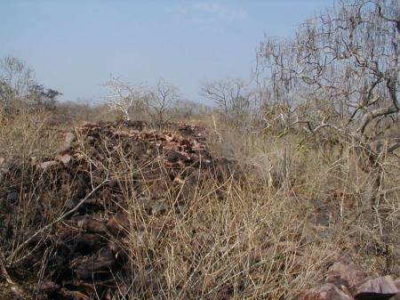
There is a long stairway to the top of the hill, carved in the hard rock, in a superbly preserved condition. At the top there is a large cremation ground where the monks were being cremated. Number of structural  stupas, small and large made of bricks  reportedly exist there. However we had to contain our temptation and had to return from Cave No.67. When we were back at the parking site of our vehicle, we found the driver blowing up. 
Steps leading to the top of the hill
Again at Borivli we caught a local train to take us back to Dadar and from there we hired a taxi to be back at home at Chembur by 7.30 PM. We need to visit again.

Thursday, March 25, 2010

Raisen Fort


Once a friend of Irish origin, Tom Baker,  from England,  happened to visit Bhopal. It was immediately after winter. Days were becoming warmer but evenings were pleasant. Friends here, proposed to take him for sightseeing to Sanchi, one of the World Heritage sites closer to Bhopal. After breakfast, we four of us, embarked upon our journey by a car driven by me. In those days the journey to Sanchi used to be horrible because of bad roads. On reaching Sanchi we took our foreign friend around the Buddhist monuments and in the process we ourselves acted as his guide. In between we also had our lunch at a restaurant preceded by chilled beer. Incidentally our friend was a teetotaler, an exception in his family.  

The steps leading up the hill
By 4.30 PM we decided to return back after visiting the local museum. For the return trip we decided upon a different route to avoid the trauma. We decided to proceed to Raisen and then to Bhopal.  Although it meant traversing around 35 kms extra. This was quite acceptable in anticipation of better road conditions ahead. The distance from Sanchi to Raisen which was around 20 kilometers had to be covered on a road which was not much better than what we had seen. However, we were at Raisen around 5.00 PM  travelling by the western side of a hill on which  ruins of a grand fort stood. This fort has always attracted me while passing through the Eastern side of the hill. Whenever we desired to have a look at that we were told that there is no motor able road leading to the fort and that it would be strenuous to climb the hill. Further some stray incidents of waylaying the visitors was also reported.  Tom, our guest also spotted the fort and was keen to know about it. Encouraged with that we decided to give a try this time. From the eastern side there was a road leading to the foot of the hill but it was full of rubble. Driving very slowly with bumps and jerks, we could manage to reach the point beyond which we were to take the dilapidated steps leading to the fort.

Mr. Devdas rested after crossing this door
We noticed some people coming down along with some tools and implements and perceived them as being masons. We conversed with them and learnt that some work was being carried out at the top. They also assured us that the place was quite safe except for some reptiles running around. We drew solace and built up courage to proceed with the climb. On reaching a turn where a huge ruined gate stood, one of our friend Mr. Devdas, expressed his inability to go any further stating that his limbs wont carry his weight. He was a little heavy built. We could only sympathize and leave him behind asking him to rest there itself.
A canopy at the entrance

The large Courtyard

The Pool
The town beneath the fort
A building with a dome in ruins
Age old Cannons
Inscription found on a wall of the Fort
When we finally entered the fort, there was wilderness all around. There was thick under growth of vegetation and wild long grass. A large court yard surrounded by many buildings with domes could be seen. All of them seems to have been taken over by thousands of bats whose chirpings could be heard from a long distance. A beautiful large pool (known as Bawadi in vernacular), though in a bad shape was in the foreground. We did not dare to explore the buildings except the one which was at the eastern edge known as Baradari. This structure was relatively in good shape and provided a breathtaking eastern view. We could even see our car parked down the hill. Adjacent to that there seemed to be a tomb in an enclosure whose doors were closed. In our assessment the structures standing there combining Hindu and Muslim styles of architectures were really beautiful . If only some restoration work is carried out, it could become a major attraction for tourists visiting Sanchi. This ruined edifice is of great historical interest as we would see from what follows. As it was getting dark, we had no option but to leave the place and climb down. On our way back, our friend Mr. Devdas was complaining that he came all the way up but could not locate us and returned because of darkness engulfing. However, we discounted his stance.

Raisen town was established by Rai Singh, a Hindu ruler in 1143 AD followed by the construction of a fort on the hill top during that period. However, remnants of an earlier fortification datable to the 6th century AD have also been encountered. In 1485 during the rule of Gayasuddin Ghouri, mosques, madrasas and several buildings were got constructed at Raisen. Another name which deserves mention is that of one Silhadi (Shiladitya) who had sway in the northern part of Malwa. He was a Tomar Rajput Chieftain. He along with the army of Rana Sanga of Mewar helped Bahadur Shah, the Sultan of Gujrat to annexe Malwa Sultanate in 1531 AD. As promised by  Bahadur Shah,Ujjain and Sarangpur were to go to Silhadi.   realizing that it would make Silhadi too powerful to control, Bahadur Shah instead  ordered Silhadi to handover Raisen fort and all his territory in Malwa and relocate to the town of Baroda. Bahadur Shah seemed to have learned his lessons from the fate of Silhadi’s previous allies. When Silhadi refused to agree to these terms, Sultan Bahadur Shah promptly took him in captivity and along with him proceeded to Raisen fort, which was being held by Silhadi’s brother Lakshman Rai. Ostensible cause of this expedition was given as to free some Muslim women in the household of Silhadi. 

Sultan’s army could not make any headway against the Raisen fort even after many months of sieze. Silhadi, however,  persuaded  Bahadur Shah to send him inside the fort so that he could convince his brother to vacate it. This was agreed to and Silhadi went inside. In an emotional family meeting, the two brothers weighed their options. Situation in the fort was hopeless because of dwindling food supplies. Durgavati, Silhadi’s wife who was also besieged in the fort, forcefully pleaded for Jauhar and Saka, a traditional Rajput victory-or-death stand. Martyrdom was decided upon. It can also be said that they had no other real choice. Nobody could realistically believe that Bahadur Shah really wanted to rehabilitate them in Baroda. In all probability he planned to put all of them  to sword as soon as they came out of the fort.
Rani Durgavati (not to be misconstrued as the Gond Rani), taking her daughter-in-law (daughter of Rana Sanga) and her two children by the hand jumped into the Chita, a fire-pit dug for the purpose. Seven hundred other women followed her in the Chita. Silhadi and Lakshman then armed themselves and died as consecrated warriors in a fight with sultan’s army at the foot of the fort. This happened in 1532 AD. During 1543 Sher Shah Suri attacked the fort and captured it from one Puranmal in whose custody it was. From 1760 onwards the fort remained with the Nawabs of Bhopal.

See through a broken dome
The Shiva Temple
The grill gate of the temple
We learn that the palaces in the fort are named as Badal Mahal, Rohini Mahal, Itradaan Mahal and Hawa Mahal but at the time of our visit there was no way to identify them. There is temple dedicated to Lord Shiva, of the 12th century, which opens its doors once a year i.e.on  Shivratri day. Devotees coming on other days usually tie a piece of cloth on the grill gate for fulfillment of their wishes. The hill also abound in rock shelters with paintings done by the cave dwellers. Although the fort is presently under the ASI, not much has been done for restoration of the palaces. Some domes have collapsed and one can see the blue sky as could be seen from the photograph here. We learn that an approach road has either been constructed or is under construction. If the reports emanating from the Ministry of Culture are to be believed, the State Government has decided to develop the fort as a tourist attraction. The MP Tourism Development Corporation is collaborating in this initiative.